
Make a donation
Gear up for your next adventure:
As an Amazon Associate, this site earns from qualifying purchases at no extra cost to you.
Zapote topographic map
Click on the map to display elevation.
Make a donation
Gear up for your next adventure:
As an Amazon Associate, this site earns from qualifying purchases at no extra cost to you.
About this map
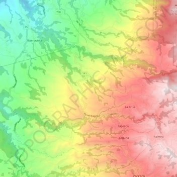
Name: Zapote topographic map, elevation, terrain.
Location: Zapote, Zarcero, Alajuela Province, 21106, Costa Rica (10.21527 -84.51750 10.27042 -84.39927)
Average elevation: 4,629 ft
Minimum elevation: 1,827 ft
Maximum elevation: 7,372 ft
Make a donation
Gear up for your next adventure:
As an Amazon Associate, this site earns from qualifying purchases at no extra cost to you.
Other topographic maps
Click on a map to view its topography, its elevation and its terrain.
Make a donation
Gear up for your next adventure:
As an Amazon Associate, this site earns from qualifying purchases at no extra cost to you.
Arenal Volcano
Costa Rica > Alajuela Province > Cantón de San Carlos > La Fortuna
Arenal has several eruptive vents. Chato is a dormant stratovolcanic cone. It is believed that Chato first erupted 38,000 years ago during the Pleistocene period and last erupted about 3,500 years ago. Chatito is a lava dome with an elevation of 1,100 metres (3,609 ft). Espina is another lava dome.
Average elevation: 3,327 ft
Make a donation
Gear up for your next adventure:
As an Amazon Associate, this site earns from qualifying purchases at no extra cost to you.
Grande River
Costa Rica > Alajuela Province > San Ramón > San Isidro > San Roque
Average elevation: 3,428 ft
La Paz
Costa Rica > Alajuela Province > Cantón de San Ramón > Piedades Norte
Average elevation: 3,825 ft
Make a donation
Gear up for your next adventure:
As an Amazon Associate, this site earns from qualifying purchases at no extra cost to you.
Río Jesús
Costa Rica > Alajuela Province > San Ramón > San Rafael > Berlín
Average elevation: 4,091 ft
Make a donation
Gear up for your next adventure:
As an Amazon Associate, this site earns from qualifying purchases at no extra cost to you.
Arenal Volcano
Costa Rica > Alajuela Province > San Carlos > La Fortuna
Arenal has several eruptive vents. Chato is a dormant stratovolcanic cone. It is believed that Chato first erupted 38,000 years ago during the Pleistocene period and last erupted about 3,500 years ago. Chatito is a lava dome with an elevation of 1,100 metres (3,609 ft). Espina is another lava dome.
Average elevation: 3,327 ft
Make a donation
Gear up for your next adventure:
As an Amazon Associate, this site earns from qualifying purchases at no extra cost to you.
Carrillos Alto
Costa Rica > Alajuela Province > Poás > Carrillos > Carrillos Bajo
Average elevation: 2,989 ft
Carrillos Bajo
Costa Rica > Alajuela Province > Cantón Poás > Carrillos > Carrillos Bajo
Average elevation: 2,736 ft