Geolocate

Ockham topographic map

Click on the map to display elevation.

About this map

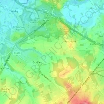
Name: Ockham topographic map, elevation, terrain.

Location: Ockham, Guildford, Surrey, England, United Kingdom (51.28150 -0.49248 51.32545 -0.41182)

Average elevation: 125 ft

Minimum elevation: 46 ft

Maximum elevation: 279 ft

Gear up for your next adventure:

🧤Hiking Gloves - Protective gloves for rugged trails
📱Heavy-Duty Phone Cases - Drop-proof and waterproof protection for outdoor navigation
📚USA Hiking Guide Books - Top trail guides and map books
🎒Waterproof Dry Bags - Keep your electronics and maps dry inside your pack
🚑Emergency Bivvies - Heat-reflective sleeping bags for survival situations

As an Amazon Associate, this site earns from qualifying purchases at no extra cost to you.