
Bin Qasim Town topographic map
Interactive map
Click on the map to display elevation.
About this map
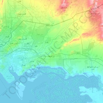
Name: Bin Qasim Town topographic map, elevation, terrain.
Location: Bin Qasim Town, Malir District, Sindh, Pakistan (24.76193 67.13498 24.98576 67.58278)
Average elevation: 148 ft
Minimum elevation: -3 ft
Maximum elevation: 719 ft