Geolocate

Tambang topographic map

Click on the map to display elevation.

About this map

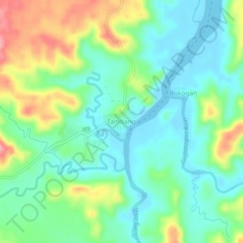
Name: Tambang topographic map, elevation, terrain.

Location: Tambang, Tinambac, Camarines Sur, Bicol Region, Philippines (13.87615 123.39493 13.91615 123.43493)

Average elevation: 118 ft

Minimum elevation: -7 ft

Maximum elevation: 361 ft

Gear up for your next adventure:

Backpacking Tents - Weight-optimized shelters for multi-day topographic surveys
🪶LED Camping Lantern - Bright lantern for camp lighting
🥾Men's Hiking Boots - Durable, waterproof footwear for rugged terrain and steep inclines
🗺️Topographic Maps - Detailed topo maps for hiking, exploring and outdoor navigation
🥾Women's Hiking Boots - Top-rated trail boots with ankle support and superior grip

As an Amazon Associate, this site earns from qualifying purchases at no extra cost to you.