
Sfisef topographic map
Interactive map
Click on the map to display elevation.
About this map
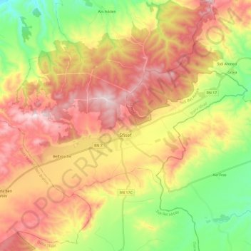
Name: Sfisef topographic map, elevation, terrain.
Location: Sfisef, Daïra Sfisef, Sidi Bel Abbès, Algérie (35.18807 -0.36224 35.29716 -0.12934)
Average elevation: 1,785 ft
Minimum elevation: 889 ft
Maximum elevation: 2,697 ft
Situé dans une cuvette à l'est du Djebel Oulad-Slimane et au sud du djebel Guétarnia entre Sidi Bel Abbès et Mascara, à une altitude de 550 mètres.