
福宝镇 topographic map
Interactive map
Click on the map to display elevation.
About this map
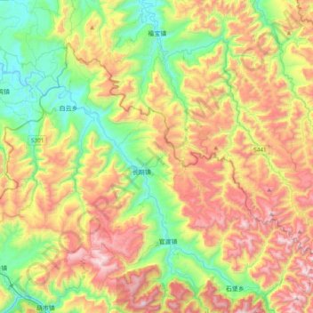
Name: 福宝镇 topographic map, elevation, terrain.
Location: 福宝镇, 合江县, 泸州市, 四川省, 中国 (28.47686 105.99605 28.80918 106.37642)
Average elevation: 2,461 ft
Minimum elevation: 735 ft
Maximum elevation: 4,921 ft
Other topographic maps
Click on a map to view its topography, its elevation and its terrain.