
Thank you for supporting this site ❤️
Make a donation
Make a donation
Gear up for your next adventure:
As an Amazon Associate, this site earns from qualifying purchases at no extra cost to you.
Takrouna topographic map
Click on the map to display elevation.
Thank you for supporting this site ❤️
Make a donation
Make a donation
Gear up for your next adventure:
As an Amazon Associate, this site earns from qualifying purchases at no extra cost to you.
About this map
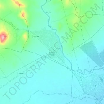
Name: Takrouna topographic map, elevation, terrain.
Location: Takrouna, تكرونة, معتمدية النفيضة, Sousse, 4030, Tunisia (36.12438 10.33030 36.16438 10.37030)
Average elevation: 157 ft
Minimum elevation: 59 ft
Maximum elevation: 581 ft
Thank you for supporting this site ❤️
Make a donation
Make a donation
Gear up for your next adventure:
As an Amazon Associate, this site earns from qualifying purchases at no extra cost to you.