Geolocate

Copalis Beach topographic map

Click on the map to display elevation.

About this map

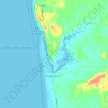
Name: Copalis Beach topographic map, elevation, terrain.

Location: Copalis Beach, Grays Harbor County, Washington, 98535, United States (47.09295 -124.19238 47.15909 -124.15209)

Average elevation: 43 ft

Minimum elevation: -13 ft

Maximum elevation: 279 ft

Grays Harbor County trails, hiking, mountain biking, running and outdoor activities

Gear up for your next adventure:

🪶Fire Starter Kit - Reliable fire starter for survival and camping
🎒Outdoor Daypacks - Lightweight backpacks designed for carrying maps and essential gear
🔌USB Car Charger - Car charger for on‑the‑go power needs
📶Satellite Messenger - Communication device off‑grid
🗺️Topographic Maps - Detailed topo maps for hiking, exploring and outdoor navigation

As an Amazon Associate, this site earns from qualifying purchases at no extra cost to you.