
Korb topographic map
Click on the map to display elevation.
About this map
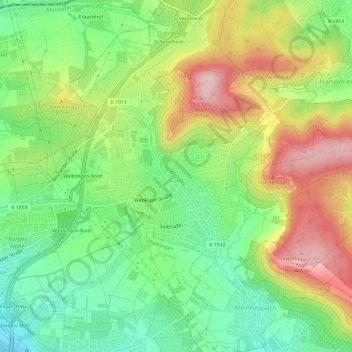
Name: Korb topographic map, elevation, terrain.
Location: Korb, Rems-Murr-Kreis, Baden-Württemberg, 71404, Germany (48.82393 9.34326 48.86285 9.39663)
Average elevation: 1,056 ft
Minimum elevation: 732 ft
Maximum elevation: 1,499 ft
Other topographic maps
Click on a map to view its topography, its elevation and its terrain.
Kleinhegnach
Germany > Baden-Württemberg > Rems-Murr-Kreis > Waiblingen > Neustadt
Average elevation: 909 ft
Dörnich
Germany > Baden-Württemberg > Rems-Murr-Kreis > Sulzbach an der Murr
Average elevation: 1,342 ft