
FuladShahr topographic map
Interactive map
Click on the map to display elevation.
About this map
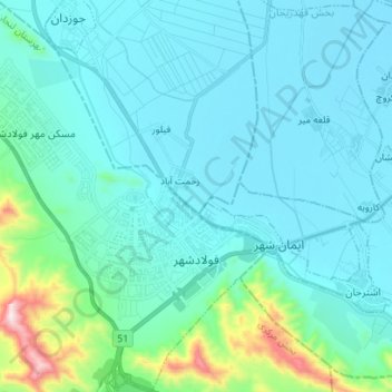
Name: FuladShahr topographic map, elevation, terrain.
Location: FuladShahr, بخش مرکزی, Lenjan County, Isfahan Province, Iran (32.44361 51.32030 32.56182 51.44190)
Average elevation: 5,610 ft
Minimum elevation: 5,279 ft
Maximum elevation: 7,799 ft
Other topographic maps
Click on a map to view its topography, its elevation and its terrain.
Chamgordan
Iran > Isfahan Province > Lenjan County > دهستان خرم رود > Chamgordan
Chamgordan, دهستان خرم رود, بخش مرکزی, Lenjan County, Isfahan Province, 8471773519, Iran
Average elevation: 5,666 ft