
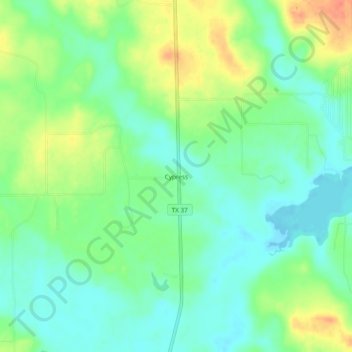
Cypress topographic map
Interactive map
Click on the map to display elevation.
About this map
Name: Cypress topographic map, elevation, terrain.
Location: Cypress, Franklin County, Texas, United States (33.02401 -95.28911 33.06401 -95.24911)
Average elevation: 436 ft
Minimum elevation: 377 ft
Maximum elevation: 531 ft
Other topographic maps
Click on a map to view its topography, its elevation and its terrain.
Mount Vernon
United States > Texas > Franklin County
Mount Vernon, Franklin County, Texas, 75457, United States
Average elevation: 472 ft