
Gaborone Dam topographic map
Interactive map
Click on the map to display elevation.
About this map
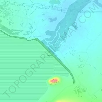
Name: Gaborone Dam topographic map, elevation, terrain.
Location: Gaborone Dam, Gaborone, South-East District, Botswana (-24.70819 25.90680 -24.69108 25.93386)
Average elevation: 3,255 ft
Minimum elevation: 3,196 ft
Maximum elevation: 3,484 ft
Other topographic maps
Click on a map to view its topography, its elevation and its terrain.
Segoditshane River
Botswana > South-East District > Gaborone
Segoditshane River, Gaborone, South-East District, Botswana
Average elevation: 3,241 ft