
Jarosławiec topographic map
Interactive map
Click on the map to display elevation.
About this map
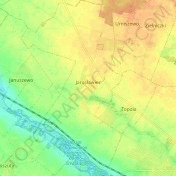
Name: Jarosławiec topographic map, elevation, terrain.
Average elevation: 292 ft
Minimum elevation: 233 ft
Maximum elevation: 335 ft
Other topographic maps
Click on a map to view its topography, its elevation and its terrain.
Środa Wielkopolska
Poland > Greater Poland Voivodeship > Środa Wielkopolska County
Środa Wielkopolska, gmina Środa Wielkopolska, Środa Wielkopolska County, Greater Poland Voivodeship, 63-000, Poland
Average elevation: 282 ft