
Quarry Lakes Regional Park topographic map
Interactive map
Click on the map to display elevation.
About this map
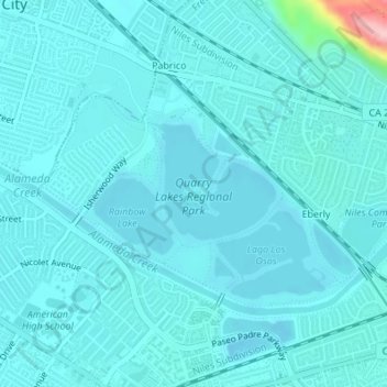
Name: Quarry Lakes Regional Park topographic map, elevation, terrain.
Average elevation: 56 ft
Minimum elevation: 7 ft
Maximum elevation: 535 ft
Other topographic maps
Click on a map to view its topography, its elevation and its terrain.
Horseshoe Lake
United States > California > Alameda County > Fremont > Eberly
Horseshoe Lake, Eberly, Fremont, Alameda County, California, United States
Average elevation: 75 ft