Geolocate

Rye topographic map

Click on the map to display elevation.

About this map

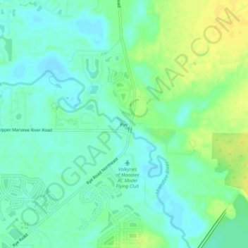
Name: Rye topographic map, elevation, terrain.

Location: Rye, Manatee County, Florida, 34212, United States (27.49448 -82.38787 27.53448 -82.34787)

Average elevation: 33 ft

Minimum elevation: 3 ft

Maximum elevation: 72 ft

Manatee County trails, hiking, mountain biking, running and outdoor activities

Gear up for your next adventure:

🧭Orienteering Set - Complete compass and map reading kit
📶Vehicle Signal Boosters - Improve reception in rural areas while driving to trailheads
🪑Ultralight Camp Chairs - Portable seating for resting after a long day of mapping
📚Navigation Handbooks - Master the art of reading topographic maps and using a compass
🪶Camping Sleeping Pad - Comfortable sleeping pad for backpacking

As an Amazon Associate, this site earns from qualifying purchases at no extra cost to you.