
Rheydt topographic map
Interactive map
Click on the map to display elevation.
About this map
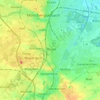
Name: Rheydt topographic map, elevation, terrain.
Location: Rheydt, Mönchengladbach, Nordrhein-Westfalen, 41236, Deutschland (51.12678 6.40406 51.20678 6.48406)
Average elevation: 213 ft
Minimum elevation: 128 ft
Maximum elevation: 371 ft