
Ayabaca topographic map
Interactive map
Click on the map to display elevation.
About this map
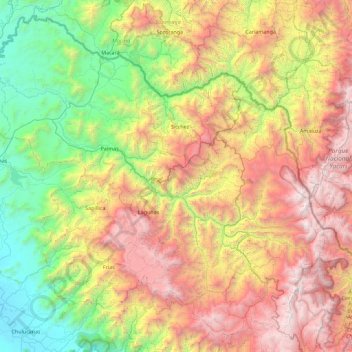
Name: Ayabaca topographic map, elevation, terrain.
Location: Ayabaca, Piura, Perú (-5.11097 -80.29671 -4.28545 -79.39024)
Average elevation: 5,259 ft
Minimum elevation: 243 ft
Maximum elevation: 12,953 ft
Other topographic maps
Click on a map to view its topography, its elevation and its terrain.