Geolocate

Mulig topographic map

Click on the map to display elevation.

About this map

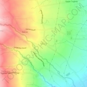
Name: Mulig topographic map, elevation, terrain.

Location: Mulig, Davao City, Davao Region, 8022, Philippines (7.06076 125.43884 7.10076 125.47884)

Average elevation: 843 ft

Minimum elevation: 482 ft

Maximum elevation: 1,253 ft

Gear up for your next adventure:

📖Nature Tracking Books - Learn to track wildlife and terrain
🪶LED Camping Lantern - Bright lantern for camp lighting
📶Vehicle Signal Boosters - Improve reception in rural areas while driving to trailheads
🌡️Handheld Weather Meters - Measure wind, temp, and pressure for safe mountain travel
🦶Carbon Trekking Poles - Reduce knee impact on steep descents with ultra-light poles

As an Amazon Associate, this site earns from qualifying purchases at no extra cost to you.