
Landershofen topographic map
Interactive map
Click on the map to display elevation.
About this map
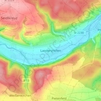
Name: Landershofen topographic map, elevation, terrain.
Average elevation: 1,496 ft
Minimum elevation: 1,250 ft
Maximum elevation: 1,736 ft
Other topographic maps
Click on a map to view its topography, its elevation and its terrain.
Hofmühle
Deutschland > Bayern > Landkreis Eichstätt > Eichstätt > Rebdorf
Hofmühle, Rebdorf, Eichstätt, Landkreis Eichstätt, Bayern, 85072, Deutschland
Average elevation: 1,558 ft
Rebdorf
Deutschland > Bayern > Landkreis Eichstätt > Eichstätt
Rebdorf, Eichstätt, Landkreis Eichstätt, Bayern, 85072, Deutschland
Average elevation: 1,549 ft