Geolocate

Fragoso topographic map

Click on the map to display elevation.

About this map

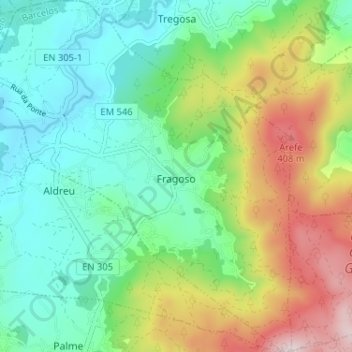
Name: Fragoso topographic map, elevation, terrain.

Location: Fragoso, Barcelos, Braga, Portugal (41.58666 -8.73245 41.63488 -8.67467)

Average elevation: 571 ft

Minimum elevation: 79 ft

Maximum elevation: 1,581 ft

Other topographic maps

Click on a map to view its topography, its elevation and its terrain.

Franqueira

Portugal > Braga > Barcelos

Average elevation: 479 ft

Gear up for your next adventure:

🔦LED Headlamp - Bright and durable LED headlamp for night navigation
🛠️Backpacking Tool Kit - Essential toolkit for outdoor repairs
🥾Women's Hiking Boots - Top-rated trail boots with ankle support and superior grip
Solar GPS Watches - Advanced multisport watches with built-in topographic maps
🪶Thermal Camp Blanket - Extra warmth for cold nights

As an Amazon Associate, this site earns from qualifying purchases at no extra cost to you.