
Thank you for supporting this site ❤️
Make a donation
Make a donation
Gear up for your next adventure:
As an Amazon Associate, this site earns from qualifying purchases at no extra cost to you.
Ferdjioua topographic map
Click on the map to display elevation.
Thank you for supporting this site ❤️
Make a donation
Make a donation
Gear up for your next adventure:
As an Amazon Associate, this site earns from qualifying purchases at no extra cost to you.
About this map
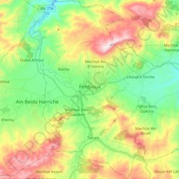
Name: Ferdjioua topographic map, elevation, terrain.
Location: Ferdjioua, Ferdjioua District, Mila, Algeria (36.33916 5.89092 36.47030 5.99290)
Average elevation: 2,146 ft
Minimum elevation: 1,096 ft
Maximum elevation: 3,757 ft
Thank you for supporting this site ❤️
Make a donation
Make a donation
Gear up for your next adventure:
As an Amazon Associate, this site earns from qualifying purchases at no extra cost to you.