

Oaxaca City topographic map
Click on the map to display elevation.
Oaxaca City
Oaxaca has a tropical savanna climate (Köppen climate classification Aw), closely bordering on a humid subtropical climate (Cwa), due to its high altitude. During the dry season, temperatures during the day remain warm with an average high of 27.1 °C (80.8 °F) in the coolest month, December, and an average high of 33.3 °C (91.9 °F) in April, just before the beginning of the wet season. Although daytime temperatures are warm, nighttime temperatures are cool with an average low of 9 °C (48 °F) in January. Due to its altitude of 1,555 m (5,102 ft), the climate of Oaxaca is cooler than lowland areas at the same latitude. Precipitation is concentrated in the summer months with June being the wettest with an average precipitation of 171 mm (6.7 in).
About this map
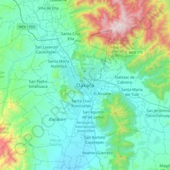
Name: Oaxaca City topographic map, elevation, terrain.
Location: Oaxaca City, Oaxaca de Juárez, Oaxaca, 68000, Mexico (16.90047 -96.88536 17.22047 -96.56536)
Average elevation: 6,030 ft
Minimum elevation: 4,885 ft
Maximum elevation: 10,768 ft