
Thank you for supporting this site ❤️
Make a donation
Make a donation
Gear up for your next adventure:
As an Amazon Associate, this site earns from qualifying purchases at no extra cost to you.
Hoegaarden topographic map
Click on the map to display elevation.
Thank you for supporting this site ❤️
Make a donation
Make a donation
Gear up for your next adventure:
As an Amazon Associate, this site earns from qualifying purchases at no extra cost to you.
About this map
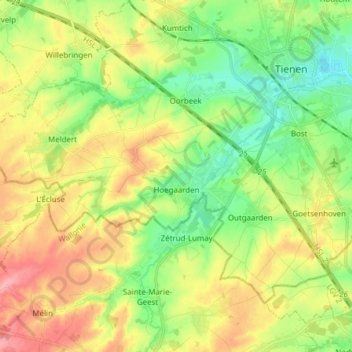
Name: Hoegaarden topographic map, elevation, terrain.
Location: Hoegaarden, Leuven, Flemish Brabant, Flanders, Belgium (50.74269 4.80055 50.81300 4.95382)
Average elevation: 253 ft
Minimum elevation: 115 ft
Maximum elevation: 433 ft
Thank you for supporting this site ❤️
Make a donation
Make a donation
Gear up for your next adventure:
As an Amazon Associate, this site earns from qualifying purchases at no extra cost to you.