
Homagama topographic map
Interactive map
Click on the map to display elevation.
About this map
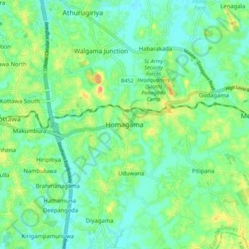
Name: Homagama topographic map, elevation, terrain.
Location: Homagama, Colombo District, Western Province, 2004, Sri Lanka (6.80127 79.96306 6.88127 80.04306)
Average elevation: 75 ft
Minimum elevation: 16 ft
Maximum elevation: 210 ft