
Torri Superiore topographic map
Interactive map
Click on the map to display elevation.
About this map
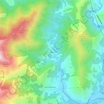
Name: Torri Superiore topographic map, elevation, terrain.
Average elevation: 1,125 ft
Minimum elevation: 89 ft
Maximum elevation: 3,294 ft
Other topographic maps
Click on a map to view its topography, its elevation and its terrain.
I Palanchi
Italie > Ligurie > Imperia > Vintimille > Torri Inferiore > Torri Superiore
I Palanchi, Torri Superiore, Torri Inferiore, Vintimille, Imperia, Ligurie, 18030, Italie
Average elevation: 1,001 ft