
Carcullion topographic map
Interactive map
Click on the map to display elevation.
About this map
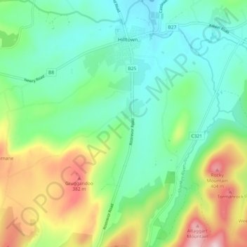
Name: Carcullion topographic map, elevation, terrain.
Average elevation: 669 ft
Minimum elevation: 322 ft
Maximum elevation: 1,450 ft
Other topographic maps
Click on a map to view its topography, its elevation and its terrain.
Spelga Reservoir
United Kingdom > Northern Ireland > Hilltown
Spelga Reservoir, Kilkeel Road, Goward, Hilltown, County Down, Northern Ireland, BT34 5XZ, United Kingdom
Average elevation: 1,250 ft