
Thank you for supporting this site ❤️
Make a donation
Make a donation
Gear up for your next adventure:
As an Amazon Associate, this site earns from qualifying purchases at no extra cost to you.
Sohier topographic map
Click on the map to display elevation.
Thank you for supporting this site ❤️
Make a donation
Make a donation
Gear up for your next adventure:
As an Amazon Associate, this site earns from qualifying purchases at no extra cost to you.
About this map
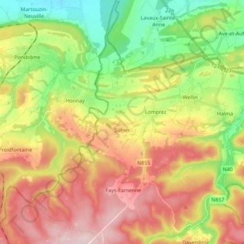
Name: Sohier topographic map, elevation, terrain.
Location: Sohier, Wellin, Neufchâteau, Luxembourg, Wallonia, Belgium (50.02055 5.01097 50.12278 5.09218)
Average elevation: 912 ft
Minimum elevation: 436 ft
Maximum elevation: 1,450 ft
Thank you for supporting this site ❤️
Make a donation
Make a donation
Gear up for your next adventure:
As an Amazon Associate, this site earns from qualifying purchases at no extra cost to you.