
Hameau Gosselin topographic map
Interactive map
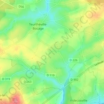
Click on the map to display elevation.
About this map
Name: Hameau Gosselin topographic map, elevation, terrain.
Average elevation: 249 ft
Minimum elevation: 135 ft
Maximum elevation: 436 ft
Other topographic maps
Click on a map to view its topography, its elevation and its terrain.
Sainte-Croix
France > Normandie > Manche > Teurthéville-Bocage
Sainte-Croix, Teurthéville-Bocage, Cherbourg, Manche, Normandie, France métropolitaine, 50630, France
Average elevation: 272 ft
Le Moulin de Coisel
France > Normandie > Manche > Teurthéville-Bocage
Le Moulin de Coisel, Teurthéville-Bocage, Cherbourg, Manche, Normandie, France métropolitaine, 50630, France
Average elevation: 240 ft
Hameau Cadel
France > Normandie > Manche > Teurthéville-Bocage
Hameau Cadel, Teurthéville-Bocage, Cherbourg, Manche, Normandie, France métropolitaine, 50630, France
Average elevation: 243 ft