
Spiennes topographic map
Interactive map
Click on the map to display elevation.
About this map
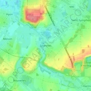
Name: Spiennes topographic map, elevation, terrain.
Location: Spiennes, Bergen, Henegouwen, Wallonië, 7032, België (50.40545 3.96690 50.44545 4.00690)
Average elevation: 177 ft
Minimum elevation: 95 ft
Maximum elevation: 354 ft