
Make a donation
Gear up for your next adventure:
As an Amazon Associate, this site earns from qualifying purchases at no extra cost to you.
Yacuma topographic map
Click on the map to display elevation.
Make a donation
Gear up for your next adventure:
As an Amazon Associate, this site earns from qualifying purchases at no extra cost to you.
About this map
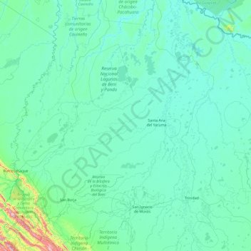
Name: Yacuma topographic map, elevation, terrain.
Location: Yacuma, Beni, Bolivia (-15.59985 -66.52654 -11.96663 -64.99781)
Average elevation: 604 ft
Minimum elevation: 400 ft
Maximum elevation: 6,060 ft
Make a donation
Gear up for your next adventure:
As an Amazon Associate, this site earns from qualifying purchases at no extra cost to you.
Other topographic maps
Click on a map to view its topography, its elevation and its terrain.
Villa Gonzales
Bolivia > Beni > General José Ballivián Segurola > San Borja > Villa Gonzales
Average elevation: 614 ft
Make a donation
Gear up for your next adventure:
As an Amazon Associate, this site earns from qualifying purchases at no extra cost to you.