
Keyworth topographic map
Interactive map
Click on the map to display elevation.
About this map
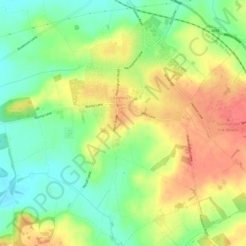
Name: Keyworth topographic map, elevation, terrain.
Location: Keyworth, Rushcliffe, Nottinghamshire, England, United Kingdom (52.85086 -1.10898 52.88696 -1.06156)
Average elevation: 223 ft
Minimum elevation: 128 ft
Maximum elevation: 325 ft