
Дубовский район topographic map
Interactive map
Click on the map to display elevation.
About this map
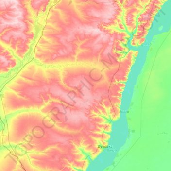
Name: Дубовский район topographic map, elevation, terrain.
Average elevation: 289 ft
Minimum elevation: 23 ft
Maximum elevation: 650 ft
Other topographic maps
Click on a map to view its topography, its elevation and its terrain.
Zimljansker Stausee
Russland > Oblast Wolgograd > Тормосиновское сельское поселение
Zimljansker Stausee, Тормосиновское сельское поселение, Чернышковский район, Oblast Wolgograd, Föderationskreis Südrussland, 347360, Russland
Average elevation: 253 ft