
Relais San Petru di Verde topographic map
Interactive map
Click on the map to display elevation.
About this map
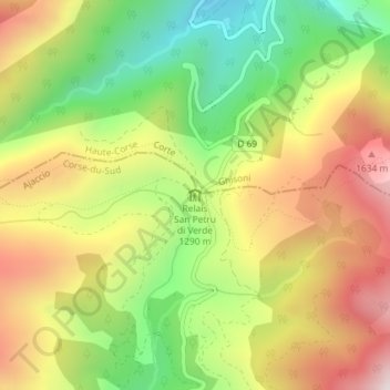
Name: Relais San Petru di Verde topographic map, elevation, terrain.
Average elevation: 4,321 ft
Minimum elevation: 3,107 ft
Maximum elevation: 5,610 ft
Other topographic maps
Click on a map to view its topography, its elevation and its terrain.
Refuge de Prati
France > Corse > Corse-du-Sud > Palneca
Refuge de Prati, GR20, Palneca, Ajaccio, Corse-du-Sud, Corse, France métropolitaine, France
Average elevation: 5,335 ft