
เกาะสมุย topographic map
Interactive map
Click on the map to display elevation.
About this map
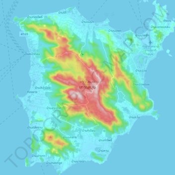
Name: เกาะสมุย topographic map, elevation, terrain.
Location: เกาะสมุย, Surat Thani, Thailand (9.40867 99.91211 9.59360 100.09061)
Average elevation: 246 ft
Minimum elevation: -3 ft
Maximum elevation: 2,037 ft
Other topographic maps
Click on a map to view its topography, its elevation and its terrain.