
Beauregard topographic map
Interactive map
Click on the map to display elevation.
About this map
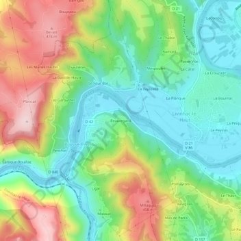
Name: Beauregard topographic map, elevation, terrain.
Average elevation: 978 ft
Minimum elevation: 574 ft
Maximum elevation: 1,654 ft
Other topographic maps
Click on a map to view its topography, its elevation and its terrain.
Ravin de Naucaze
France > Occitanie > Aveyron > Boisse-Penchot > Le Vert
Ravin de Naucaze, Le Vert, Boisse-Penchot, Villefranche-de-Rouergue, Aveyron, Occitanie, France métropolitaine, 12300, France
Average elevation: 1,184 ft