
Peña Cebollera topographic map
Interactive map
Click on the map to display elevation.
About this map
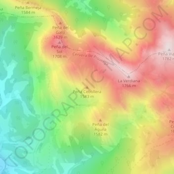
Name: Peña Cebollera topographic map, elevation, terrain.
Average elevation: 4,813 ft
Minimum elevation: 3,868 ft
Maximum elevation: 5,823 ft
Other topographic maps
Click on a map to view its topography, its elevation and its terrain.
Embalse de la Requejada
España > Castilla y León > Cervera de Pisuerga > Vañes
Embalse de la Requejada, CL-627, Vañes, Cervera de Pisuerga, Palencia, Castilla y León, 34840, España
Average elevation: 3,829 ft
Peñas Negras
España > Castilla y León > Cervera de Pisuerga
Peñas Negras, Cervera de Pisuerga, Palencia, Castilla y León, España
Average elevation: 3,730 ft
Curavacas
España > Castilla y León > Cervera de Pisuerga
Curavacas, Cervera de Pisuerga, Palencia, Castilla y León, 34887, España
Average elevation: 6,604 ft