Geolocate

Mat-i topographic map

Click on the map to display elevation.

About this map

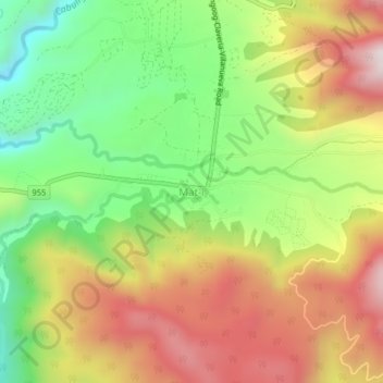
Name: Mat-i topographic map, elevation, terrain.

Location: Mat-i, Misamis Oriental, Northern Mindanao, Philippines (8.61299 124.96577 8.65299 125.00577)

Average elevation: 3,258 ft

Minimum elevation: 2,093 ft

Maximum elevation: 4,541 ft

Other topographic maps

Click on a map to view its topography, its elevation and its terrain.

Gingoog

Philippines > Misamis Oriental

Average elevation: 1,470 ft

Gear up for your next adventure:

Backpacking Tent - Lightweight and durable tent for multi‑day hikes
🥾Hiking Shoes - Durable and comfortable shoes for trail hiking
🛰️Satellite Messengers - Emergency SOS and two-way messaging for off-grid adventures
📶Satellite Messenger - Communication device off‑grid
🪶Multi‑Purpose Knife - Useful blade for camp and trail

As an Amazon Associate, this site earns from qualifying purchases at no extra cost to you.