
Langenbruck topographic map
Interactive map
Click on the map to display elevation.
About this map
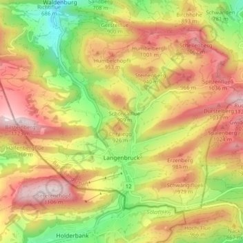
Name: Langenbruck topographic map, elevation, terrain.
Location: Langenbruck, Bezirk Waldenburg, Bâle-Campagne, 4438, Suisse (47.33788 7.72900 47.37743 7.80625)
Average elevation: 2,713 ft
Minimum elevation: 1,729 ft
Maximum elevation: 3,629 ft