
Amercœur topographic map
Interactive map
Click on the map to display elevation.
About this map
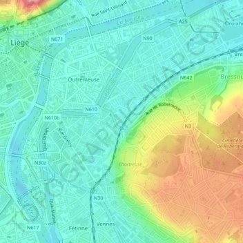
Name: Amercœur topographic map, elevation, terrain.
Location: Amercœur, Luik, Wallonië, 4000, België (50.62999 5.58399 50.64258 5.60545)
Average elevation: 269 ft
Minimum elevation: 177 ft
Maximum elevation: 482 ft
Other topographic maps
Click on a map to view its topography, its elevation and its terrain.
Jupille-sur-Meuse
Jupille-sur-Meuse, Luik, Wallonië, 4000, België
Average elevation: 436 ft