
Curinga topographic map
Interactive map
Click on the map to display elevation.
About this map
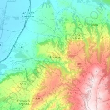
Name: Curinga topographic map, elevation, terrain.
Location: Curinga, Catanzaro, Calabre, 88022, Italie (38.79168 16.21328 38.86460 16.35683)
Average elevation: 1,050 ft
Minimum elevation: 10 ft
Maximum elevation: 3,002 ft
Other topographic maps
Click on a map to view its topography, its elevation and its terrain.