
Swallow topographic map
Interactive map
Click on the map to display elevation.
About this map
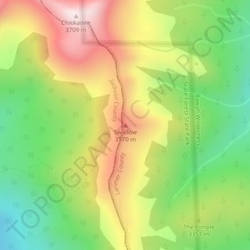
Name: Swallow topographic map, elevation, terrain.
Average elevation: 10,912 ft
Minimum elevation: 9,882 ft
Maximum elevation: 12,139 ft
Other topographic maps
Click on a map to view its topography, its elevation and its terrain.
Estes Park
Estados Unidos da América > Colorado > Larimer County > Estes Park > Estes Park
Estes Park, Larimer County, Colorado, 80517, Estados Unidos da América
Average elevation: 8,074 ft