
Kolmkar (Kohlenkar) topographic map
Interactive map
Click on the map to display elevation.
About this map
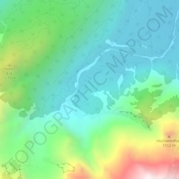
Name: Kolmkar (Kohlenkar) topographic map, elevation, terrain.
Average elevation: 3,041 ft
Minimum elevation: 1,949 ft
Maximum elevation: 5,965 ft
Other topographic maps
Click on a map to view its topography, its elevation and its terrain.
In der Röll
Österreich > Oberösterreich > Bezirk Gmunden > Grünau im Almtal
In der Röll, Grünau im Almtal, Bezirk Gmunden, Oberösterreich, 4645, Österreich
Average elevation: 3,675 ft
Almsee
Österreich > Oberösterreich > Bezirk Gmunden > Grünau im Almtal
Almsee, Grünau im Almtal, Bezirk Gmunden, Oberösterreich, 4645, Österreich
Average elevation: 2,402 ft