
Braives topographic map
Interactive map
Click on the map to display elevation.
About this map
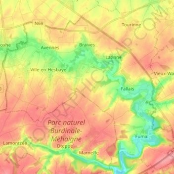
Name: Braives topographic map, elevation, terrain.
Location: Braives, Luik, Wallonië, 4260, België (50.57087 5.08058 50.64936 5.20971)
Average elevation: 486 ft
Minimum elevation: 312 ft
Maximum elevation: 627 ft