
Cachora topographic map
Interactive map
Click on the map to display elevation.
About this map
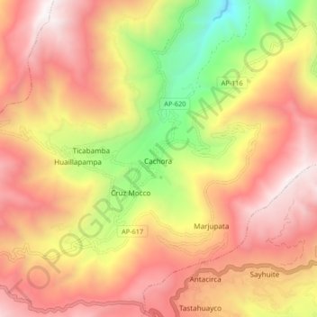
Name: Cachora topographic map, elevation, terrain.
Location: Cachora, Abancay, Apurímac, Pérou (-13.55211 -72.85289 -13.47211 -72.77289)
Average elevation: 11,296 ft
Minimum elevation: 7,569 ft
Maximum elevation: 14,085 ft