
Presa "Taxhimay" topographic map
Interactive map
Click on the map to display elevation.
About this map
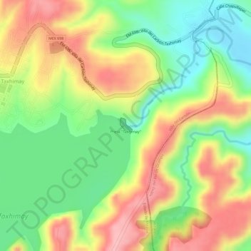
Name: Presa "Taxhimay" topographic map, elevation, terrain.
Location: Presa "Taxhimay", Villa del Carbón, Estado de México, México (19.83437 -99.38527 19.83603 -99.38390)
Average elevation: 7,356 ft
Minimum elevation: 7,096 ft
Maximum elevation: 7,615 ft
Other topographic maps
Click on a map to view its topography, its elevation and its terrain.
Presa del Llano
México > Estado de México > Villa del Carbón
Presa del Llano, Villa del Carbón, Estado de México, México
Average elevation: 9,534 ft