
La Fontaine de Villée topographic map
Interactive map
Click on the map to display elevation.
About this map
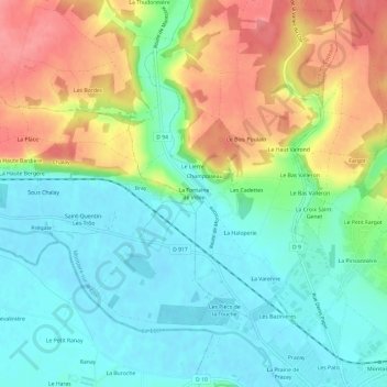
Name: La Fontaine de Villée topographic map, elevation, terrain.
Average elevation: 305 ft
Minimum elevation: 203 ft
Maximum elevation: 466 ft
Other topographic maps
Click on a map to view its topography, its elevation and its terrain.
Les Malvoisies
France > Centre-Val de Loire > Loir-et-Cher > Fontaine-les-Coteaux
Les Malvoisies, Fontaine-les-Coteaux, Vendôme, Loir-et-Cher, Centre-Val de Loire, France métropolitaine, 41800, France
Average elevation: 423 ft
L'Être Tariau
France > Centre-Val de Loire > Loir-et-Cher > Fontaine-les-Coteaux > L'Être Tariau
L'Être Tariau, Fontaine-les-Coteaux, Vendôme, Loir-et-Cher, Centre-Val de Loire, France métropolitaine, 41800, France
Average elevation: 430 ft