
Farmington topographic map
Interactive map
Click on the map to display elevation.
About this map
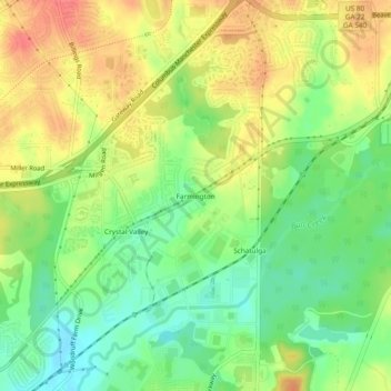
Name: Farmington topographic map, elevation, terrain.
Average elevation: 354 ft
Minimum elevation: 259 ft
Maximum elevation: 456 ft
Other topographic maps
Click on a map to view its topography, its elevation and its terrain.
Muscogee
United States > Georgia > Muscogee County > Columbus > Muscogee
Muscogee, Columbus, Muscogee County, Georgia, 31906, United States
Average elevation: 272 ft