
Reserva Nacional Las Vicuñas topographic map
Interactive map
Click on the map to display elevation.
About this map
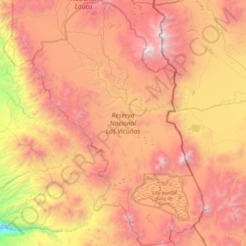
Name: Reserva Nacional Las Vicuñas topographic map, elevation, terrain.
Average elevation: 13,898 ft
Minimum elevation: 7,178 ft
Maximum elevation: 19,843 ft
Other topographic maps
Click on a map to view its topography, its elevation and its terrain.
Lago Chungará
Chile > Región de Arica y Parinacota > Putre
Lago Chungará, Cruce Longitudinal (Loma Lluta) - Parinacota - Tambo Quemado, Sopocalane, Putre, Provincia de Parinacota, Región de Arica y Parinacota, Chile
Average elevation: 15,157 ft
Lauca
Chile > Región de Arica y Parinacota > Putre > Lauca
Lauca, Putre, Provincia de Parinacota, Región de Arica y Parinacota, Chile
Average elevation: 13,750 ft