میلان بابااحمدی topographic map
Interactive map
Click on the map to display elevation.
About this map
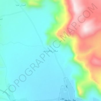
Name: میلان بابااحمدی topographic map, elevation, terrain.
Average elevation: 6,211 ft
Minimum elevation: 5,728 ft
Maximum elevation: 7,507 ft

Click on the map to display elevation.
Name: میلان بابااحمدی topographic map, elevation, terrain.
Average elevation: 6,211 ft
Minimum elevation: 5,728 ft
Maximum elevation: 7,507 ft