Geolocate

Nicasio topographic map

Click on the map to display elevation.

About this map

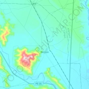
Name: Nicasio topographic map, elevation, terrain.

Location: Nicasio, Province of Lampa, Puno, Peru (-15.28410 -70.35740 -15.16554 -70.22592)

Average elevation: 12,733 ft

Minimum elevation: 12,546 ft

Maximum elevation: 14,154 ft

Gear up for your next adventure:

🛰️Handheld GPS Units - Professional satellite navigators for precise backcountry mapping
🗃️Trail First Aid Kit - Essential kit for outdoor injuries and emergencies
🥘Titanium Cookware - Durable, featherlight pots and pans for backpacking
📷Action Cameras - Rugged cameras to document your journeys across rugged terrain
🌡️Handheld Weather Meters - Measure wind, temp, and pressure for safe mountain travel

As an Amazon Associate, this site earns from qualifying purchases at no extra cost to you.